An innovation factory. Engineering high-precision digital infrastructure across Outpost Analytics, Koru, and Orbit Aerial Data.

Aggregates federal and state risk data — fire, flood, wetlands, groundwater, and more. Search any California address and download a presentation-ready risk report in seconds.
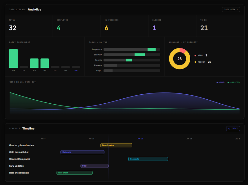
A Windows desktop app that tracks what you're working on and what you've delegated to others. Everything stays on your machine — no cloud, no account, no setup. Running in under two minutes.
FAA Part 107 drone work producing aerial photography, top-down site maps, and 3D models for real estate, construction, and commercial development. Delivered through a private client portal.
Digital storefronts for local businesses. Custom software for trades and niche operations. Tell us what you're trying to solve or build — we scope it tight and ship fast.